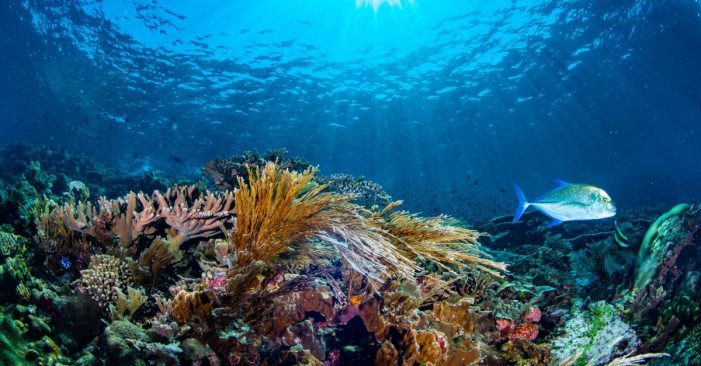
Today, The Nature Conservancy (TNC), one of the world’s leading conservation organizations, along with partners, published detailed maps of important shallow underwater habitats throughout the entire Caribbean – including all shallow water coral reefs. For the first time ever, countries and territories now have a clear picture of the habitats found beneath the waves of the Caribbean. These revolutionary maps will help guide the sustainable use and protection of marine resources for island nations in which 60% of living coral has been lost in the past few decades alone.
These maps were created by stitching together tens of thousands of high-resolution satellite images, and in some places using aerial fly-over technology, drones, and divers to dig deeper and validate the data. By utilizing data captured from outer space to undersea, scientists were able to map and more accurately interpret the coastal ecosystems throughout the Caribbean. Having accurate and complete underwater habitat data for this region means that there is now cutting-edge guidance available to inform the sustainable use of marine resources on which 44 million Caribbean residents depend.
“You cannot protect what you don’t know is there. Having access to these maps is a game-changing achievement for the Caribbean. Thirty countries and territories finally have access to better, more detailed information about their underwater habitats to help them better protect marine areas, support sustainable livelihoods and prioritize their adaptation to potential climate change impacts,” said Dr. Robert Brumbaugh, Executive Director of The Nature Conservancy’s Caribbean Division. “Understanding and protecting natural resources is critical to the economic success of these countries.”
Roughly half of all livelihoods in Caribbean communities depend on healthy nearshore and coastal habitats, including fishing and tourism. According to a study published by TNC in 2019, every year coral reefs and reef-associated activities generate an estimated $7.9 billion in economic value to the tourism industry and draw nearly 11 million visitors to Caribbean islands. These maps are intended to inform a diverse array of conservation and policy decisions to protect and restore these essential coastal areas that people depend on. Decision-makers across the region can now use these new maps to identify areas optimal for coral restoration activities, guide climate change adaptation, and identify the best locations for establishing marine protected areas that successfully balance protection and diverse uses.
“The scope of these maps is unprecedented in the region, and the opportunities they unlock to provide a better future for Caribbean ecosystems, and the millions of people who depend upon them, are astonishing” commented Dr. Joseph Pollock, Senior Coral Reef Resilience Scientist for TNC. “Using traditional approaches, it would have taken approximately 250 million diver hours to map such a large area. New technologies have helped deliver these desperately needed maps at a tiny fraction of the effort and cost.”
TNC scientists, in partnership with the Arizona State University Center for Global Discovery and Conservation Science (ASU GDCS), worked with Planet Labs Inc. to stitch together more than 38,000 high-resolution satellite images – a process similar to putting together a massive puzzle piece by piece. The finalized maps are now available at CaribbeanMarineMaps.tnc.org and TNC is working with Vulcan Inc. to make them available on the Allen Coral Atlas in 2021. These maps reveal in great detail the location of coral reefs, seagrass beds, and other oases of underwater life, making it possible to more accurately monitor the impacts of climate change, measure the effects of hurricanes and identify areas that need protection and restoration.
“Working with TNC to enhance the value of Allen Coral Atlas offerings and data will be a tremendous asset to the coral conservation community,” said Paulina Gerstner, Program Director of the Allen Coral Atlas. “This high-resolution view of Caribbean shallow reef ecosystems perfectly augments the global mapping work being undertaken by the Atlas partnership.”
On some islands, researchers combined high-resolution satellite imagery from Planet Labs Inc. with imaging spectroscopy data captured from ASU’s Global Airborne Observatory (GAO). The GAO is an airborne laboratory housing advanced Earth imaging technology, developed by Dr. Greg Asner, Director of ASU GDCS and the GAO. The airplane’s four integrated remote sensing technologies collect high-resolution data for environmental monitoring. The findings were then validated with aerial drone imaging and on-site diver surveys.
“The GAO maps provide details about reefs that cannot be gleaned from satellite data, such as the location of corals on the seafloor. We used these GAO maps, for example, to specifically delineate the best locations for coral outplanting” said Asner.
As part of a pilot test on using these maps in the field, the Dominican Republic became the first country to utilize this new technology. In 2019, TNC and local partners, including Fundación Grupo Puntacana and Fundación Dominicana de Estudios Marinos, led a coral planting event to help restore endangered staghorn corals. Scientists used the data acquired by the GAO’s fly-over to identify the best locations to plant corals – including where they would be most likely to survive and have greatest positive impact. This research guided one of the most comprehensive coral planting efforts in the history of the Dominican Republic.
“These maps are now being distributed and made widely available to a variety of stakeholders across the Caribbean. Working with partners, we will use these maps to strategically expand marine protected areas, inform smarter coral reef restoration, support nature-based solutions against the threats of climate change, and overall catalyze more effective conservation actions” added Dr. Steve Schill, Lead Scientist for TNC’s Caribbean Division.
This work was generously funded by Daniel C. Chung, Kowalski Family Foundation, The Tiffany & Co. Foundation, Community Foundation of the Virgin Islands, J.A. Woollam Foundation, MacArthur Foundation and Paul G. Allen Family Foundation.

